- Ohio History in 2000 Words
- Mound Builders
- Native Ohioans
- The Ohio Company
- Ohio's Wood Forts
- Indian Wars
- War of 1812
- Ohio's Canals
- Ohio's Road
- Scenic Railroads / Museums
- Underground Railroad
- Civil War in Ohio

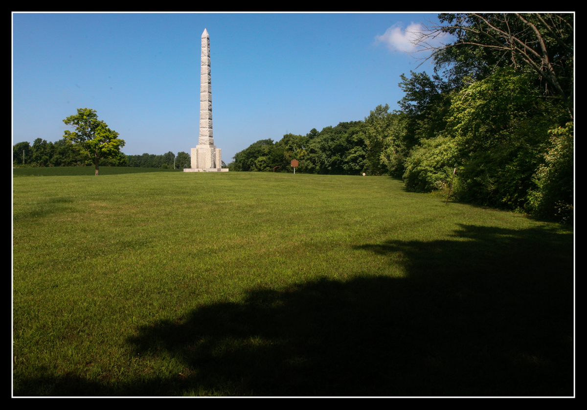
Fort Amanda site with memorial marker erected in 1916
Located just southwest of Lima Ohio, the location of Fort Amanda has been preserved with a stone monument and surrounded by a large greens pace which highlights where the actual fort was located along the west bank of the Auglaize River (in the above photo looking north, the river is located to the right).

Above photo is the Auglaize River just below where Fort Amanda was located. The Auglaize has its headwaters southeast of this location between Uniopolis and Waynesfield Ohio. It eventually empties into the Maumee River where Fort Defiance was located and from there it was another 45 miles Fort Meigs.
Fort Amanda was an ideal location for a major supply fort. Although there was always risk of enemy attack either from the British or Native Americans the location of the fort provided an elevated view of the surrounding land. Also, at this point the Auglaize River was deep enough to allow resupply boats to travel further north by water instead of overland through the swampy land common to northwest Ohio in the early 1800s.
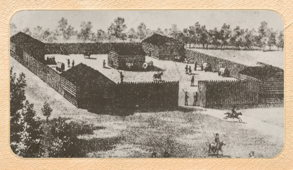
Artist rendering of what the original Fort Amanda may have resembled. It was known to have had 4 corner blockhouses with a well. Some months after its construction, the fort was expanded to make room for additional supplies, livestock and men moving north and returning.
The fort was constructed on the west side of the Auglaize River on the site of an old Ottawa Indian village. It was built in two stages. The first stage included a 4 blockhouses located at the corners of a 198' square stockade. This was structure was then enlarged so the structure was expanded to the north by about 130'.
Besides being a supply depot the fort also began building ships (scows) that could navigate the Auglaize River all the way to Fort Meigs, making it easier to safely move supplies between the forts.
Fort Amanda main purpose was supply depot under orders of General Harrison during the War of 1812 under the direction of Lt. Colonel Robert Pogue in 1812. It was initially of a square construction 160x160 feet with 4 block houses at each of the corners. With the oncoming threat of a British invasion, which was met at Fort Meigs in the spring of 1813, Fort Amanda was enlarged so it could hold the increasing amount of men, supplies and livestock coming up from Cincinnati. Herds of livestock would arrive here by land where they would be slaughtered, smoked and packed in barrels before being shipped further north.
On the eastern side of the river just south of Fort Amanda, a large boat yard was created to convert freshly cut trees into flat-bottomed boats. Those boats were then floated down the Auglaize River to the fort where they would be loaded with men and supplies before continuing further north.
On April 8, 1813, General William Harrison and a force of 400 men arrived at Fort Amanda. The next day they departed from the fort for the long river trip north to Fort Meigs which was still under construction. Just 3 weeks later these men would come under fire at Fort Meigs when the British began their siege.
Lt. Colonel Robert Pogue
Was born in 1767 in Rockbridge County Virginia. He married Martha Jane Hopkins, also of Virginia in 1791. In time they would have 13 children: Martha, Mary, John, William, Edwin, Amy, Hannah, Amanda, Jane Robert, Robert Cunningham, Ann, Joseph and Ann Eliza.
It was his 12 year old daughter, Hannah Amanda Pogue, that the 45 year old Lieutenant Colonel named this new supply fort, the only wood fortification constructed in Ohio to be named for a daughter.
After the war in 1817, a few settlers arrived here and Fort Amanda was used at the first post office in Allen County and also became the first religious meeting-house. It became one of earliest population centers in Allen County.
Recent interest in Fort Amanda has resulted in an initial archeological survey of the area. The goal is to try to determine the exact location of the the fort.
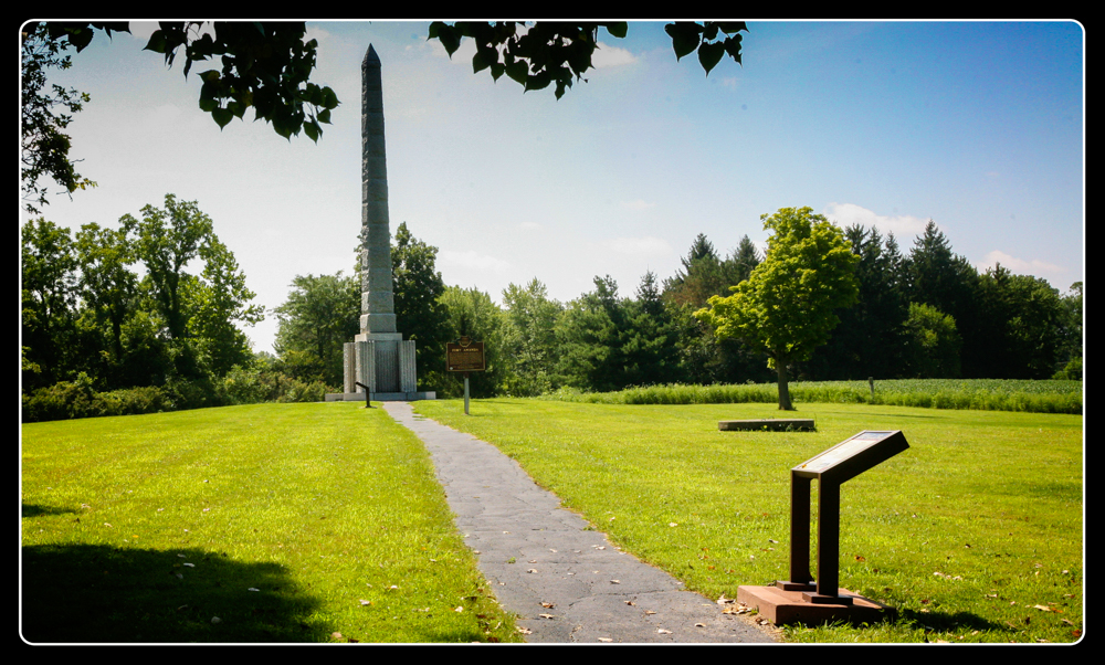
Although Fort Amanda had long been lost in the intervening years, its importance and stature had grown to the defense of our state and country on the western frontier. In 1913 the land on which the fort was built that had been under the protection of the fort Amanda Commission was turned over to the State of Ohio for $1.00 and in 1913 the site became a State Memorial. Two years later the 50' monument was constructed where it was thought to be the center of the fort.

Bronze plaque placed on the 50' tall monument erected by the Allen County Mausoleum Co.
During the Great Depression, the Civilian Conservation Corps improved the site with construction of a shelter house and other buildings that still stand today on the north side of the cemetery .

In memoriam of those that died while serving at Fort Amanda there are 75 gravestones honoring those unnamed soldiers are located in what is now known as Fort Amanda Cemetery that serves local families.
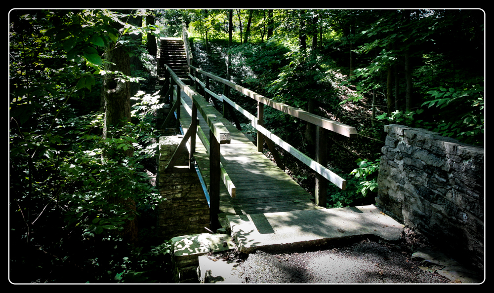
On the north side of the cemetery there's picnic tables, shelter house, restrooms and a parking lot. From the parking lot there's a paved path leading south to the Fort Amanda Monument. There's a few stairs and a bridge traversing a ravine.
©
Ohio City Productions, Inc.
All Rights Reserved.

